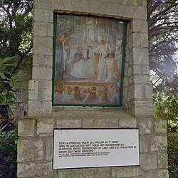
File:Exterieur processiepark, afbeelding historische scène - 20000648 - RCE.jpg

Original file(3,090 × 3,090 pixels, file size: 3.58 MB, MIME type: image/jpeg)

This is a file from the Wikimedia Commons. Information from its description page there is shown below.
Commons is a freely licensed media file repository. You can help.

Summary

Albin Windhausen: Q23669194  wikidata:Q23669194 reasonator:Q23669194
Artist
Albin Windhausen  (1863–1946)  wikidata:Q15869690 s:nl:Hoofdportaal:Beeldende kunst/Schilderkunst/Nederland/Ca. 1850-ca. 1914/Albin Windhausen
 
Alternative names
Albinus Windhausen
Description Dutch painter
Date of birth/death 20 May 1863 Edit this at Wikidata 15 September 1946 Edit this at Wikidata
Location of birth/death Waldniel Roermond
Work period from 1873 until 1946
date QS:P,+1500-00-00T00:00:00Z/6,P580,+1873-00-00T00:00:00Z/9,P582,+1946-00-00T00:00:00Z/9
Work location
Authority file
creator QS:P170,Q15869690
 Edit this at Wikidata
image of artwork listed in title parameter on this page
Author
Kris Roderburg    wikidata:Q59248002
 
Kris Roderburg
Description Dutch photographer
Working for the Rijksdienst voor het Cultureel Erfgoed (or one of its predecessors)
Work location
Amersfoort (2002–2017) Edit this at Wikidata
Authority file
creator QS:P170,Q59248002
Title
Dutch:
Kroning van het Mariabeeld
label QS:Lnl,"Kroning van het Mariabeeld"
Object type painting Edit this at Wikidata
Description
Nederlands: Kruiswegpark: Exterieur processiepark, afbeelding historische scène
This is an image of rijksmonumentcomplex number
520504
This is an image of rijksmonument number 520507

Information from structured data:

Address
InfoField
Parklaan 3
6045 BS Roermond
Netherlands
Date July 2001
institution QS:P195,Q15876366
Source/Photographer Rijksdienst voor het Cultureel Erfgoed
Object location51° 10′ 44.94″ N, 5° 59′ 47.11″ E Kartographer map based on OpenStreetMap.View this and other nearby images on: OpenStreetMapinfo

Licensing

w:en:Creative Commons
attribution share alike
This file is licensed under the Creative Commons Attribution-Share Alike 4.0 International license.
You are free:
  • to share – to copy, distribute and transmit the work
  • to remix – to adapt the work
Under the following conditions:
  • attribution – You must give appropriate credit, provide a link to the license, and indicate if changes were made. You may do so in any reasonable manner, but not in any way that suggests the licensor endorses you or your use.
  • share alike – If you remix, transform, or build upon the material, you must distribute your contributions under the same or compatible license as the original.

Captions

Add a one-line explanation of what this file represents

Items portrayed in this file

depicts

51°10'44.94"N, 5°59'47.11"E

image/jpeg

File history

Click on a date/time to view the file as it appeared at that time.

Date/TimeThumbnailDimensionsUserComment
current21:02, 21 March 2020Thumbnail for version as of 21:02, 21 March 20203,090 × 3,090 (3.58 MB)Vysotskyhigher res. (from same source)
18:45, 23 December 2012Thumbnail for version as of 18:45, 23 December 20121,200 × 1,200 (308 KB)BotMultichill{{subst:RCE data ingestion layout|subst=subst: |@attributes_created=2009-04-19T10:05:45 |@attributes_modification=2012-10-25T09:10:03 |@attributes_priref=20000648 |@attributes_selected=False |Content_subject_content.subject=Statie |Description_descript...

Global file usage

Metadata