File:Map of the Black Hills region, 1877.jpg

Size of this preview: 715 × 600 pixels. Other resolutions: 286 × 240 pixels | 573 × 480 pixels | 916 × 768 pixels | 1,221 × 1,024 pixels | 2,443 × 2,048 pixels | 5,943 × 4,983 pixels.
Original file (5,943 × 4,983 pixels, file size: 8.84 MB, MIME type: image/jpeg)
Summary
| Description |
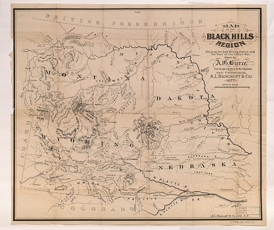
English: Map of the Black Hills region : showing the gold mining district and the seat of the Indian war, by Ambrose Bierce, 1877. |
| Date | |
| Source | http://id.lib.harvard.edu/aleph/013787889/catalog |
| Author | Ambrose Bierce |
| Permission (Reusing this file) |
This is a media file that the Harvard Map Collection believes to be in the public domain of the United States. This applies to a work published before January 1, 1923, or the unpublished work of an author who died more than 70 years ago. The Harvard Map Collection and Harvard University claim no rights in this photographic reproduction of the work. The image is free to download and reproduce for any use, commercial or non-commercial, without any further permission required. Where these media files are used, The Harvard Map Collection asks to be credited as: Courtesy of Harvard Map Collection, Harvard Library, http://nrs.harvard.edu/urn-3:FHCL:21809693?buttons=y. If this media file infringes your rights or the rights of any third parties, or if the file is not properly identified or acknowledged, please contact: maps@harvard.edu. Read more about the Harvard Library Policy on Access to Digital Reproductions of Works in the Public Domain on the [https://osc.hul.harvard.edu/programs/open-initiatives/hl-pd/ HL Office of Scholarly Communication website |
Licensing
|
This work is in the public domain in its country of origin and other countries and areas where the copyright term is the author's life plus 70 years or fewer. This work is in the public domain in the United States because it was published (or registered with the U.S. Copyright Office) before January 1, 1929. | |
| This file has been identified as being free of known restrictions under copyright law, including all related and neighboring rights. | |
File history
Click on a date/time to view the file as it appeared at that time.
| Date/Time | Thumbnail | Dimensions | User | Comment | |
|---|---|---|---|---|---|
| current | 18:26, 18 January 2018 | | 5,943 × 4,983 (8.84 MB) | Mcmcg11 | User created page with UploadWizard |
File usage
The following 2 pages use this file: