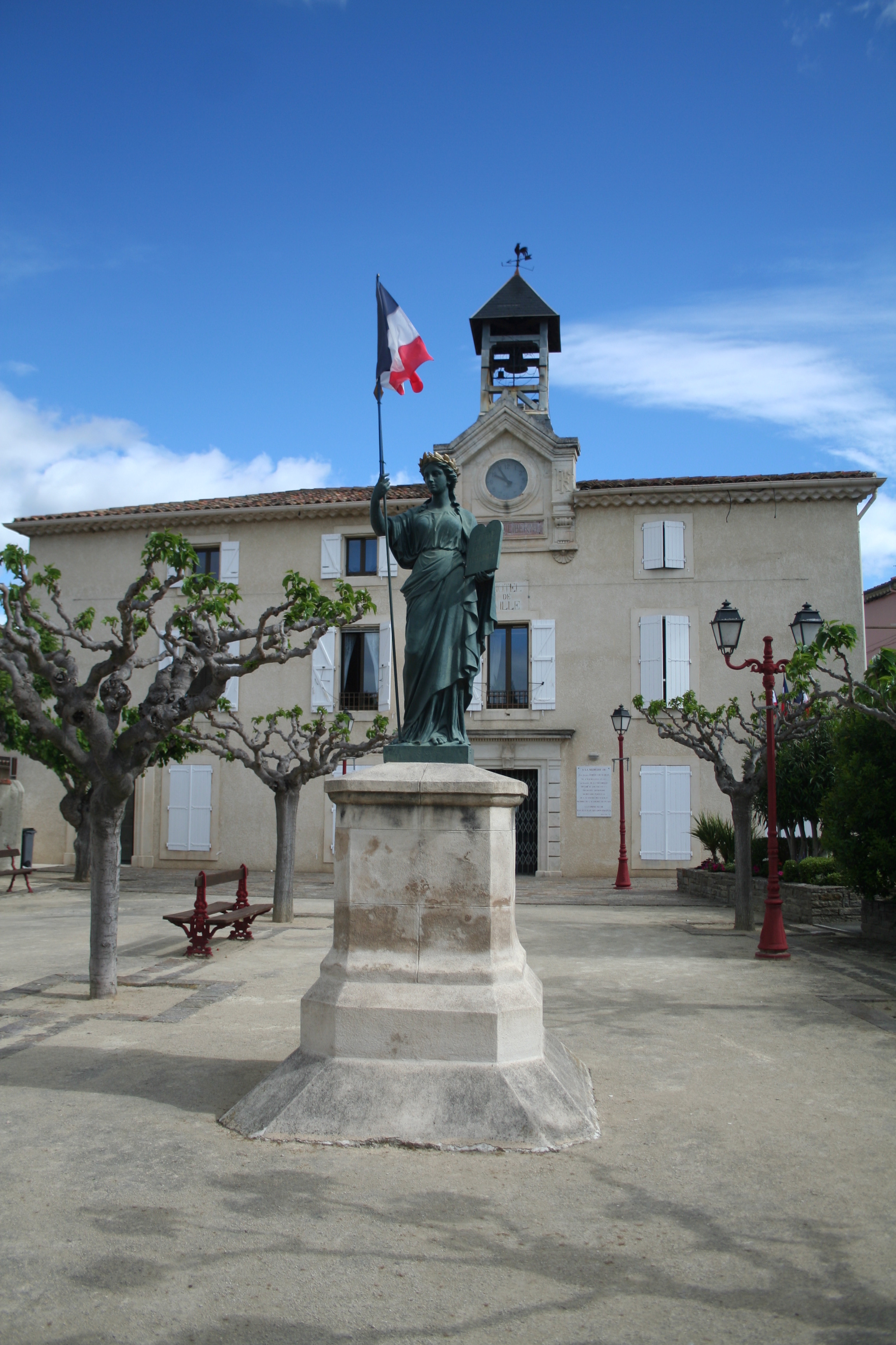
File:Maureilhan Marianne.JPG
Size of this preview: 400 × 600 pixels. Other resolutions: 160 × 240 pixels | 320 × 480 pixels | 512 × 768 pixels | 682 × 1,024 pixels | 2,304 × 3,456 pixels.
Original file (2,304 × 3,456 pixels, file size: 2.63 MB, MIME type: image/jpeg)
Summary
Object
| Antoine Durenne: Q106889882
|
||||||||||||||||||||||||||||||
|---|---|---|---|---|---|---|---|---|---|---|---|---|---|---|---|---|---|---|---|---|---|---|---|---|---|---|---|---|---|---|
| Artist |
|
 | ||||||||||||||||||||||||||||
| Title |
French: Monument de la République |
|||||||||||||||||||||||||||||
| Object type |
sculpture |
|||||||||||||||||||||||||||||
| Genre |
public art |
|||||||||||||||||||||||||||||
| Description |
|
|||||||||||||||||||||||||||||
| Date |
between 1875 and 1895 |
|||||||||||||||||||||||||||||
| Medium |
cast iron |
|||||||||||||||||||||||||||||
| Dimensions |
height: 200 cm (78.7 in) |
|||||||||||||||||||||||||||||
| Collection |
|
|||||||||||||||||||||||||||||
| Object location |
|
|||||||||||||||||||||||||||||
| References |
Palissy ID: IM34001703 |
|||||||||||||||||||||||||||||
.jpg)
Photograph
| Date |
|
| Source | Own work, Fagairolles 34, 2013-05-12 09:04:50 |
| Author |
Fagairolles 34 |
| Camera location | | View this and other nearby images on: OpenStreetMap |
|---|
Licensing
I, the copyright holder of this work, hereby publish it under the following license:
This file is licensed under the Creative Commons Attribution-Share Alike 4.0 International license.
- You are free:
- to share – to copy, distribute and transmit the work
- to remix – to adapt the work
- Under the following conditions:
- attribution – You must give appropriate credit, provide a link to the license, and indicate if changes were made. You may do so in any reasonable manner, but not in any way that suggests the licensor endorses you or your use.
- share alike – If you remix, transform, or build upon the material, you must distribute your contributions under the same or compatible license as the original.
File history
Click on a date/time to view the file as it appeared at that time.
| Date/Time | Thumbnail | Dimensions | User | Comment | |
|---|---|---|---|---|---|
| current | 09:17, 19 May 2013 | | 2,304 × 3,456 (2.63 MB) | Fagairolles 34 | User created page with UploadWizard |
File usage
The following 4 pages use this file:
Global file usage
The following other wikis use this file:
- Usage on ca.wikipedia.org
- Usage on ceb.wikipedia.org
- Usage on ce.wikipedia.org
- Usage on de.wikipedia.org
- Usage on el.wikipedia.org
- Usage on eo.wikipedia.org
- Usage on es.wikipedia.org
- Usage on eu.wikipedia.org
- Usage on fr.wikipedia.org
- Usage on hu.wikipedia.org
- Usage on it.wikipedia.org
- Usage on ku.wikipedia.org
- Usage on lld.wikipedia.org
- Usage on lmo.wikipedia.org
- Usage on ms.wikipedia.org
- Usage on nl.wikipedia.org
- Usage on pl.wikipedia.org
- Usage on pt.wikipedia.org
- Usage on ro.wikipedia.org
- Usage on sk.wikipedia.org
- Usage on tt.wikipedia.org
- Usage on uk.wikipedia.org
- Usage on vec.wikipedia.org
- Usage on zh-min-nan.wikipedia.org
- Usage on zh-yue.wikipedia.org
- Usage on zh.wikipedia.org