File:Roches Douvres-2.jpg

Size of this preview: 406 × 600 pixels. Other resolutions: 162 × 240 pixels | 325 × 480 pixels | 520 × 768 pixels | 693 × 1,024 pixels | 1,754 × 2,592 pixels.
Original file (1,754 × 2,592 pixels, file size: 916 KB, MIME type: image/jpeg)
| Description |
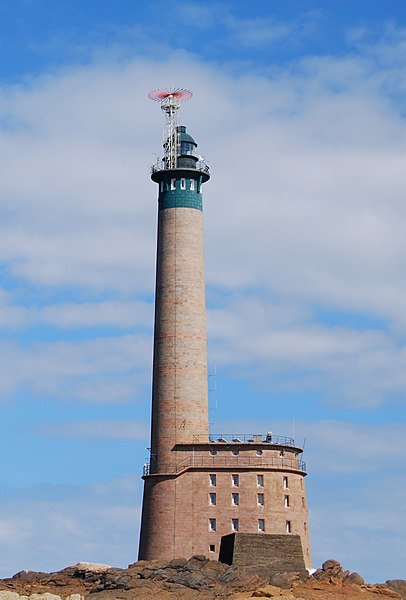
English: Roches-Douvres Lighthouse, English Channel, Côtes-d'Armor, Brittany, France. A plateau of rocks between France and Guernsey. Français : Phare des Roches-Douvres, La Manche (mer), Côtes-d'Armor, Bretagne, France. Português: Farol das Roches-Douvres, Canal da Mancha, Côtes-d'Armor, Bretanha, França. |
| Date | (UTC) |
| Source | |
| Author |
|
| Object location | | View this and other nearby images on: OpenStreetMap |
|---|
| This is a retouched picture, which means that it has been digitally altered from its original version. Modifications: croped. The original can be viewed here: Roches Douvres.jpg:
|
I, the copyright holder of this work, hereby publish it under the following license:
This file is licensed under the Creative Commons Attribution-Share Alike 2.0 Generic license.
- You are free:
- to share – to copy, distribute and transmit the work
- to remix – to adapt the work
- Under the following conditions:
- attribution – You must give appropriate credit, provide a link to the license, and indicate if changes were made. You may do so in any reasonable manner, but not in any way that suggests the licensor endorses you or your use.
- share alike – If you remix, transform, or build upon the material, you must distribute your contributions under the same or compatible license as the original.
Original upload log
This image is a derivative work of the following images:
- File:Roches_Douvres.jpg licensed with Cc-by-sa-2.0
- 2009-11-11T20:13:44Z JotaCartas 3872x2592 (2119766 Bytes) {{Information |Description= |Source=[http://www.flickr.com/photos/24749174@N06/2745539586/ Roches Douvres] |Date=2008-08-05 17:08 |Author=[http://www.flickr.com/people/24749174@N06 Clément
Uploaded with derivativeFX
File history
Click on a date/time to view the file as it appeared at that time.
| Date/Time | Thumbnail | Dimensions | User | Comment | |
|---|---|---|---|---|---|
| current | 05:34, 2 December 2009 | | 1,754 × 2,592 (916 KB) | JotaCartas | {{Information |Description={{en|1=Roches-Douvres Lighthouse, English Channel, Côtes-d'Armor, Brittany, France. A plateau of rocks between France and Guernsey.}} {{fr|1=Phare des Roches-Douvres, La Manche (mer), Côtes-d'Armor, Bretagne, France.}} {{pt|1= |
File usage
The following 3 pages use this file:
Global file usage
The following other wikis use this file:
- Usage on br.wikipedia.org
- Usage on de.wikipedia.org
- Benutzer:Markus Bärlocher/Leuchtfeuer
- Benutzer:Kpfiwa/Testseite
- Liste der höchsten Leuchttürme der Welt
- Liste der Monuments historiques in Caurel (Côtes-d’Armor)
- Liste der Monuments historiques in La Chèze
- Liste der Monuments historiques in Le Mené
- Liste der Monuments historiques in Corlay
- Liste der Monuments historiques in Erquy
- Liste der Monuments historiques in Binic-Étables-sur-Mer
- Liste der Monuments historiques in Plémet
- Liste der Monuments historiques in Le Fœil
- Liste der Monuments historiques in Gausson
- Liste der Monuments historiques in Le Haut-Corlay
- Liste der Monuments historiques in Hémonstoir
- Liste der Monuments historiques in Hénansal
- Liste der Monuments historiques in Hénon
- Liste der Monuments historiques in Plœuc-L’Hermitage
- Liste der Monuments historiques in Hillion
- Liste der Monuments historiques in Île-de-Bréhat
- Liste der Monuments historiques in Jugon-les-Lacs
- Liste der Monuments historiques in Lamballe-Armor
- Liste der Monuments historiques in Plouguenast-Langast
- Liste der Monuments historiques in Lantic
- Liste der Monuments historiques in Le Leslay
- Liste der Monuments historiques in Merdrignac
- Liste der Monuments historiques in Merléac
- Liste der Monuments historiques in Moncontour (Côtes-d’Armor)
- Liste der Monuments historiques in Guerlédan
- Liste der Monuments historiques in Noyal
- Liste der Monuments historiques in Plaine-Haute
- Liste der Monuments historiques in Plaintel
- Liste der Monuments historiques in Plédéliac
- Liste der Monuments historiques in Plédran
- Liste der Monuments historiques in Plémy
- Liste der Monuments historiques in Plénée-Jugon
- Liste der Monuments historiques in Pléneuf-Val-André
- Liste der Monuments historiques in Plérin
- Liste der Monuments historiques in Plestan
- Liste der Monuments historiques in Ploufragan
- Liste der Monuments historiques in Plumieux
- Liste der Monuments historiques in Plussulien
- Liste der Monuments historiques in Quessoy
- Liste der Monuments historiques in Le Quillio
- Liste der Monuments historiques in Quintin (Côtes-d’Armor)
- Liste der Monuments historiques in Saint-Alban (Côtes-d’Armor)
- Liste der Monuments historiques in Saint-Bihy
- Liste der Monuments historiques in Saint-Caradec
- Liste der Monuments historiques in Saint-Carreuc
- Liste der Monuments historiques in Saint-Denoual
View more global usage of this file.