Property talk:P1944
Documentation
relief location map
relief location map of place
relief location map of place
[create Create a translatable help page (preferably in English) for this property to be included here]
Link to Commons namespace “File”: this property should contain a well-formed link to an existing page on Wikimedia Commons. (Help)
List of violations of this constraint: Database reports/Constraint violations/P1944#Commons link, hourly updated reportFormat “
List of violations of this constraint: Database reports/Constraint violations/P1944#Format, hourly updated report, SPARQL(?i).+\.(jpg|jpeg|png|svg|tif|tiff|gif)”: value must be formatted using this pattern (PCRE syntax). (Help)Scope is as main value (Q54828448): the property must be used by specified way only (Help)
List of violations of this constraint: Database reports/Constraint violations/P1944#Scope, hourly updated report, SPARQLAllowed entity types are Wikibase item (Q29934200): the property may only be used on a certain entity type (Help)
Exceptions are possible as rare values may exist. Exceptions can be specified using exception to constraint (P2303). List of violations of this constraint: Database reports/Constraint violations/P1944#Entity types
|
This property is being used by: Please notify projects that use this property before big changes (renaming, deletion, merge with another property, etc.) |
| This entity (P1944) is used by Wikimedia's setting of Wikidata. Please contact the development team or file a bug on Phabricator before big changes (renaming, deletion, merging, etc.). |
Comparison of map properties
-
 locator map image (P242) is a map suitable for an infobox for the item itself, showing where an entity is located in a wider area
 -
 location map (P1943) is a largely blank map, suitable for a push-pin to be added in an infobox for a place within the item -- the most major roads, railways and rivers are marked, but not the details of most settlements.
 -
 detail map (P1621) is for a detailed map or plan of the item, which is probably already too 'busy' to allow further annotation
 -
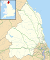
 relief location map (P1944) for a relief variant of the location map


_p2.300_-_Map_of_Northumberland.jpg)
